🗺️ Idaho County Map (With and Without Labels)
Idaho, known as the Gem State, is famous for its rugged mountains, clear lakes, and vast wilderness areas. Located in the Pacific Northwest, Idaho is divided into 44 counties, each offering a unique mix of natural beauty and small-town charm.
Below, you’ll find two versions of the Idaho County Map — one with county labels and one blank version without labels. Both maps are available in .webp format for fast loading and sharp display quality.
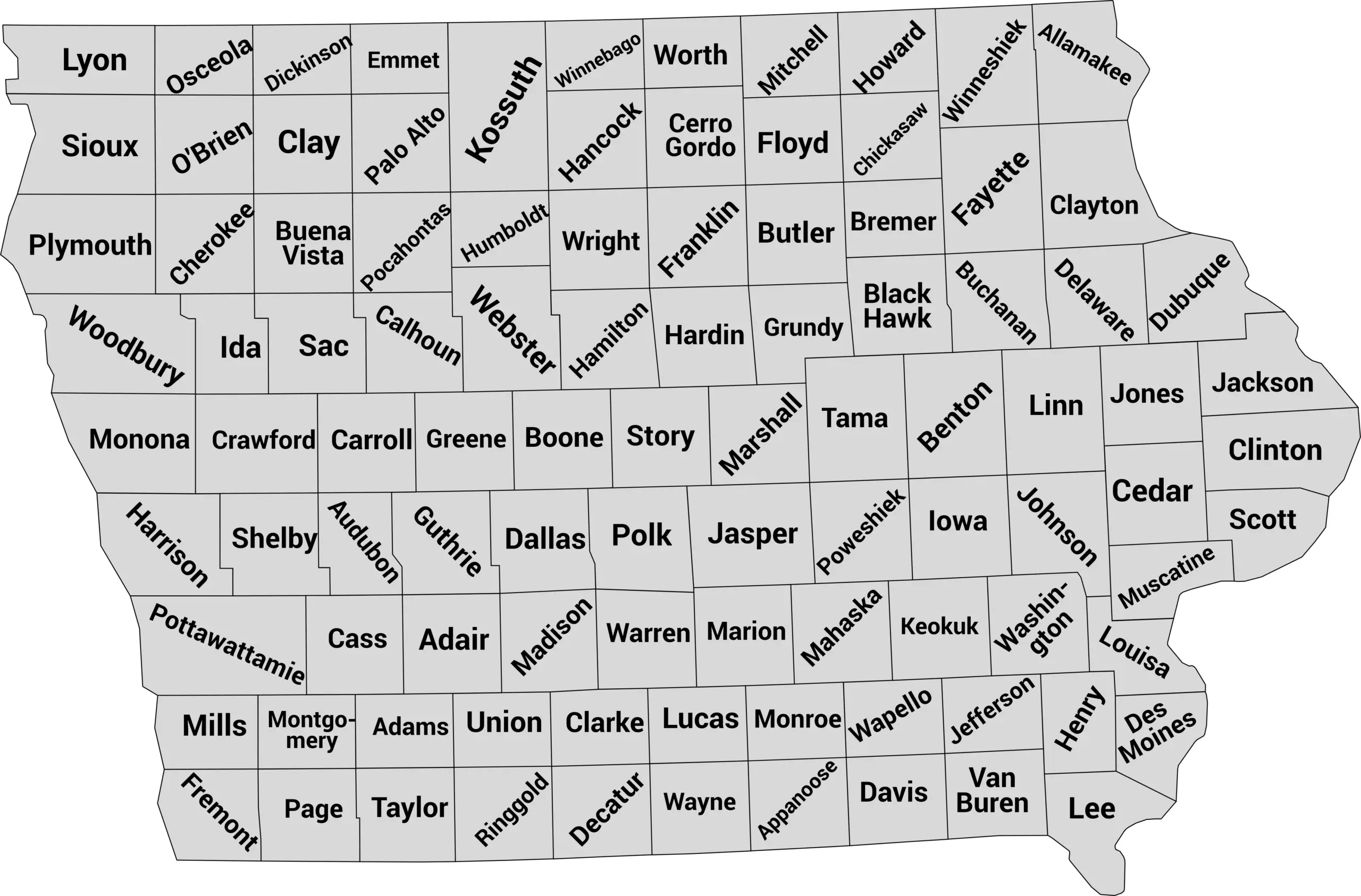
📍 Idaho County Map with Labels
The labeled Idaho county map below displays all 44 counties clearly outlined and named. It’s perfect for studying Idaho’s geography, planning trips, or visualizing data by county.
🖼️ Idaho County Map (with labels):
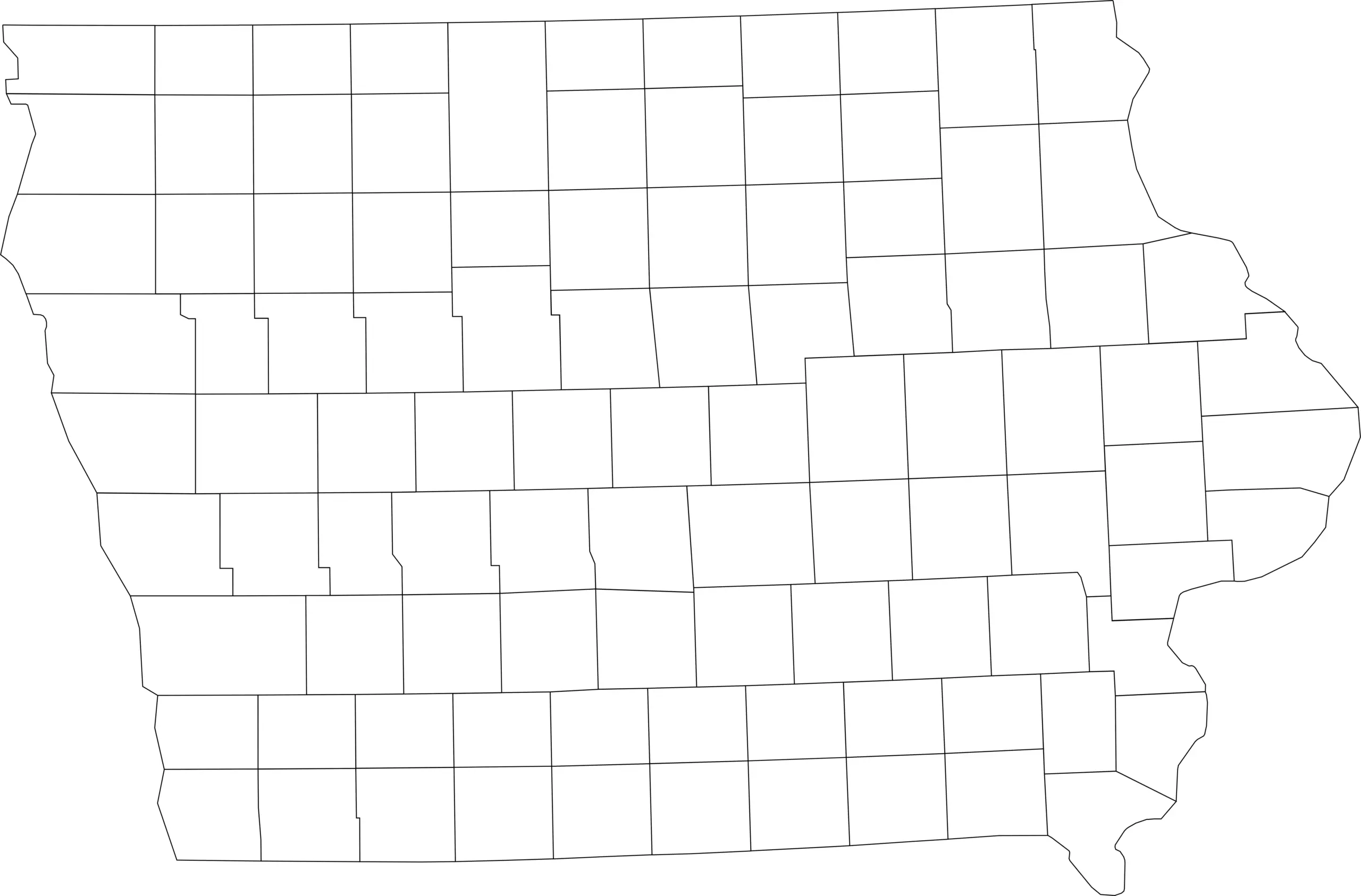
🌄 Blank Idaho County Map (No Labels)
The blank Idaho county map provides a clean outline of all county borders without names. It’s ideal for classroom exercises, quizzes, coloring projects, or custom geographic labeling.
🖼️ Idaho County Map (without labels):
🧭 About Idaho’s Counties
Idaho’s counties cover diverse terrain — from forested mountains to fertile valleys. Here are a few notable ones:
- Ada County — Home to Boise, the state capital and largest city.
- Canyon County — A rapidly growing area in the Treasure Valley region.
- Kootenai County — Known for Coeur d’Alene and its beautiful northern lakes.
- Bonneville County — Includes Idaho Falls, a major eastern Idaho hub.
- Blaine County — Home to Sun Valley, a world-renowned ski destination.
Each county contributes to Idaho’s rugged beauty and outdoor lifestyle, offering opportunities for adventure, agriculture, and exploration.
🧾 Uses for the Idaho County Map
These maps can be used for:
✅ Educational lessons and classroom activities
✅ Geography and history projects
✅ Travel and regional research
✅ Coloring or labeling practice
✅ Data and demographic visualization
📥 Download Idaho County Maps
You can download the high-quality .webp maps below for free:
Both maps are printable, easy to use, and perfect for education, research, or personal projects.
📊 Idaho Counties by Population (2025 Estimates)
Idaho has 44 counties, ranging from fast-growing urban areas to very sparsely populated rural regions. The most recent U.S. Census Bureau population estimates show that Idaho has continued to grow, with the majority of residents living in the larger metro-area counties around Boise and northern Idaho.
| County | Estimated Population (2025) |
|---|---|
| Ada County | 544,908 |
| Canyon County | 275,042 |
| Kootenai County | 191,409 |
| Bonneville County | 135,813 |
| Twin Falls County | 97,614 |
| Bannock County | 91,010 |
| Madison County | 55,549 |
| Bonner County | 53,955 |
| Bingham County | 50,889 |
| Nez Perce County | 42,847 |
| Clark County | <1,000 |
🔍 Key Highlights
- Ada County is by far the most populous county in Idaho, home to the state capital, Boise, and surrounding suburbs — hosting well over half a million residents.
- Canyon County, just west of Ada, is the second largest and part of the fast-growing Treasure Valley region.
- Kootenai County in northern Idaho (around Coeur d’Alene) ranks third and has seen substantial growth as well.
- At the other end of the scale, Clark County remains the least populated, with fewer than 1,000 residents. World Population Review
🧠 Frequently Asked Questions About the Idaho County Map
How many counties are in Idaho?
Idaho has 44 counties, each serving as a local government unit within the state.
Which is the largest county by population?
Ada County is the most populous county in Idaho and includes Boise, the state capital.
Which county is the largest by land area?
Idaho County is the largest by land area, covering a vast portion of central Idaho and rugged wilderness terrain.
What is the smallest county in Idaho?
Clark County is the smallest county by population, while Payette County is the smallest by land area.
Does Idaho use counties for local government?
Yes. Idaho counties provide essential services such as law enforcement, courts, elections, road maintenance, and public records.
What is the Idaho county map with labels used for?
A labeled county map helps identify county boundaries, major cities, and regional divisions throughout Idaho.
What is the blank Idaho county map used for?
The blank map is ideal for educational labeling, quizzes, classroom lessons, homeschooling, and custom mapping projects.
Are Idaho counties divided into regions?
Yes. Idaho is often divided into regions such as Northern Idaho, Southwestern Idaho, Central Idaho, and Eastern Idaho to describe geographic and cultural differences.
Why are Idaho counties important for land and resource management?
Idaho counties manage large rural areas and work closely with state and federal agencies on land use, agriculture, forestry, and natural resource planning.
🌎 Explore More Maps
View more nearby state maps:


