🗺️ Massachusetts County Map (With and Without Labels)
Massachusetts, known as the Bay State, is famous for its rich history, coastal beauty, and vibrant cities. Located in New England, it’s divided into 14 counties, each with its own mix of coastal towns, farmland, and historic communities.
Below, you’ll find two versions of the Massachusetts County Map — one with county labels and one blank version without labels. Both maps are provided in .webp format for fast-loading, high-quality display on your website.
📍 Massachusetts County Map with Labels
The labeled Massachusetts county map below clearly shows all 14 counties. It’s ideal for students, teachers, travelers, or anyone exploring the geography of Massachusetts.
🖼️ Massachusetts County Map (with labels):
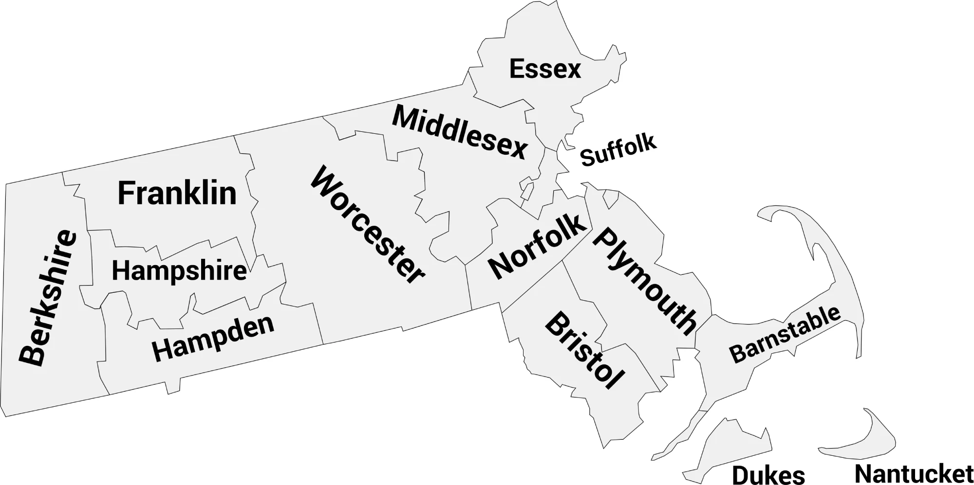
Download Labeled Massachusetts County Map (.webp)
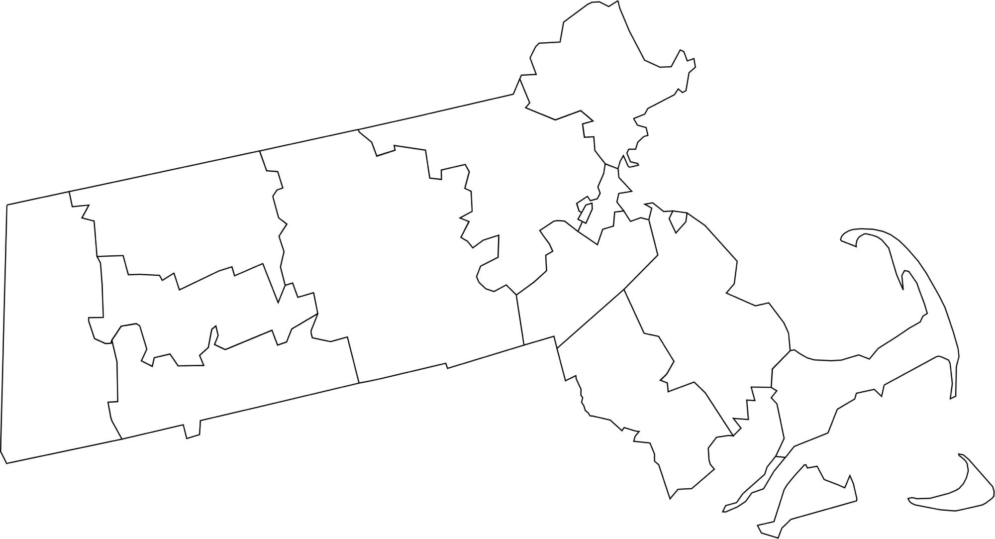
🌄 Blank Massachusetts County Map (No Labels)
The blank Massachusetts county map provides a clean outline of all county borders without names. It’s perfect for classroom use, quizzes, or custom labeling and coloring projects.
🖼️ Massachusetts County Map (without labels):
🧭 About Massachusetts’ Counties
Massachusetts’ counties range from coastal areas to forested western regions. Here are a few notable examples:
- Suffolk County — Home to Boston, the state’s capital and largest city.
- Middlesex County — Includes Cambridge and Lowell, known for universities and innovation.
- Worcester County — The largest county by area, located in central Massachusetts.
- Barnstable County — Covers Cape Cod, famous for beaches and coastal towns.
- Berkshire County — Located in the western mountains, known for outdoor recreation and arts.
Each county highlights a different aspect of Massachusetts’ culture, economy, and geography.
🧾 Uses for the Massachusetts County Map
These maps are perfect for:
✅ Educational lessons and geography projects
✅ Travel and regional planning
✅ Data visualization and county analysis
✅ Coloring or labeling activities
✅ Local history and research projects
📥 Download Massachusetts County Maps
You can download high-quality .webp versions of both maps:
Both maps are printable, lightweight for web, and ideal for educational, personal, or professional use.
📊 Massachusetts Counties by Population (Estimated)
Here’s a complete table for Massachusetts, including all 14 counties, alphabetical, with estimated populations (2024–2025)
| County | Estimated Population |
|---|---|
| Barnstable County | 223,000 |
| Berkshire County | 124,000 |
| Bristol County | 579,000 |
| Dukes County | 21,000 |
| Essex County | 810,000 |
| Franklin County | 70,000 |
| Hampden County | 470,000 |
| Hampshire County | 160,000 |
| Middlesex County | 1,650,000 |
| Nantucket County | 15,000 |
| Norfolk County | 720,000 |
| Plymouth County | 530,000 |
| Suffolk County | 775,000 |
| Worcester County | 830,000 |
🧠 Frequently Asked Questions About the Massachusetts County Map
How many counties are in Massachusetts?
Massachusetts has 14 counties, each historically serving as local government units, though some now exist mainly for geographic and historical purposes.
Which is the largest county by population?
Middlesex County is the most populous county in Massachusetts, with over 1.6 million residents.
Which county is the largest by land area?
Plymouth County is among the largest counties by land area in Massachusetts.
What is the smallest county in Massachusetts?
Nantucket County is the smallest county by population and is an island county off the coast.
Does Massachusetts use counties for local government?
Some counties in Massachusetts have limited or no county government. Many services are provided at the state or municipal level, but counties still exist for geographic and historical purposes.
What is the Massachusetts county map with labels used for?
A labeled county map helps users identify county boundaries, major cities, and regional divisions across the state.
What is the blank Massachusetts county map used for?
The blank map is ideal for educational labeling, classroom exercises, quizzes, homeschooling, and custom mapping projects.
Are Massachusetts counties divided into regions?
Yes. Massachusetts is commonly divided into regions such as Greater Boston, Central Massachusetts, Western Massachusetts, and the Cape & Islands.
Why are Massachusetts counties important for education and mapping?
Even though county governments are limited, counties are important for historical research, demographic studies, legal jurisdictions, and geographic reference.
🌎 Explore More Maps
View more nearby state maps:


