🗺️ Arizona County Map (With and Without Labels)
Arizona, known for its desert landscapes, stunning canyons, and historic Wild West towns, is divided into 15 unique counties — each with its own culture, geography, and history. Whether you’re a student, traveler, or map enthusiast, this Arizona County Map is a great way to explore and learn more about the state’s regions.
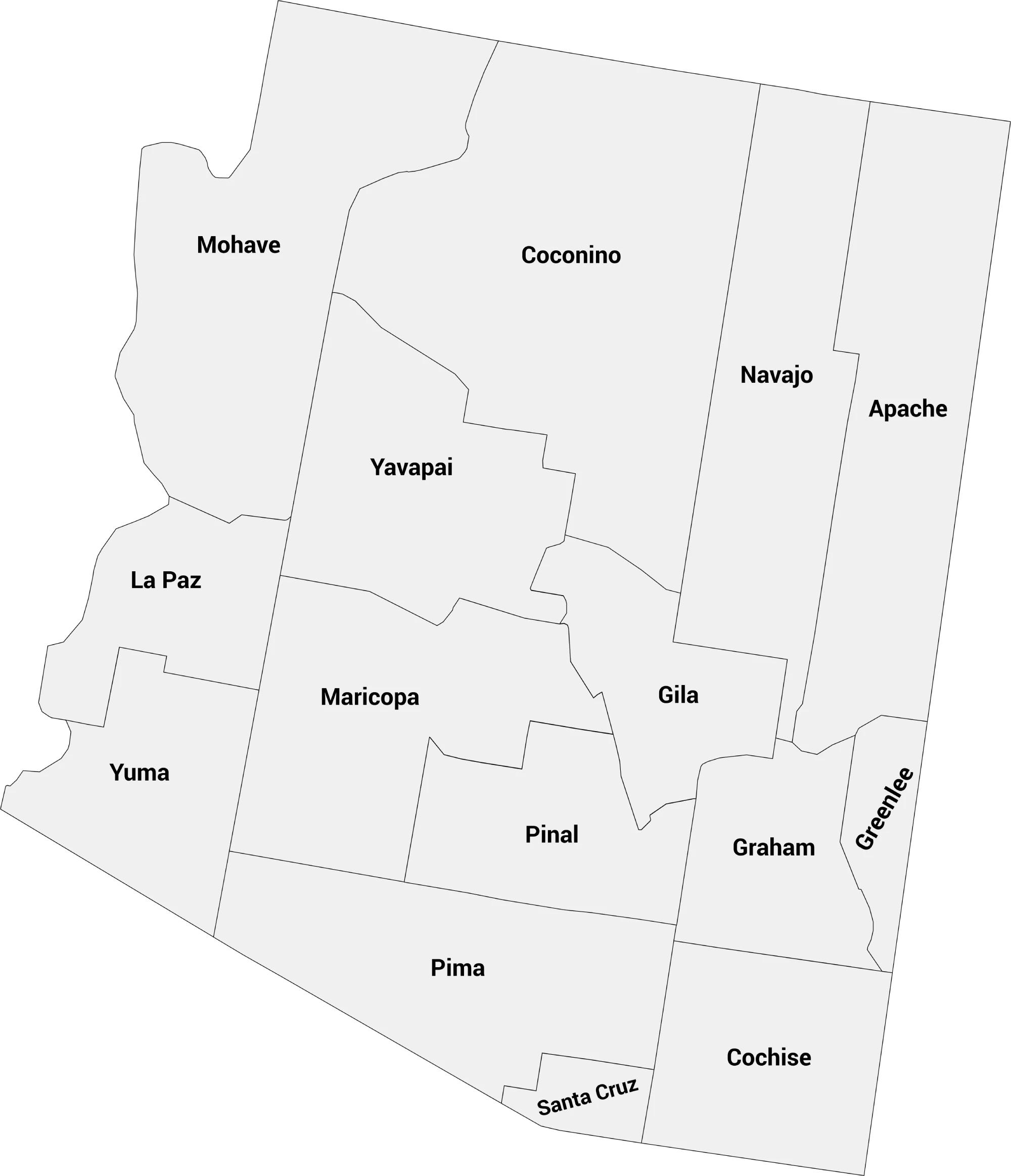
📍 Arizona County Map with Labels
Below is a labeled Arizona county map, showing all 15 counties with their borders clearly defined.
This map is ideal for reference, study, and geography projects.
Counties include:
Apache, Cochise, Coconino, Gila, Graham, Greenlee, La Paz, Maricopa, Mohave, Navajo, Pima, Pinal, Santa Cruz, Yavapai, and Yuma.
🖼️ Arizona County Map (with labels):
Download Labeled Arizona County Map
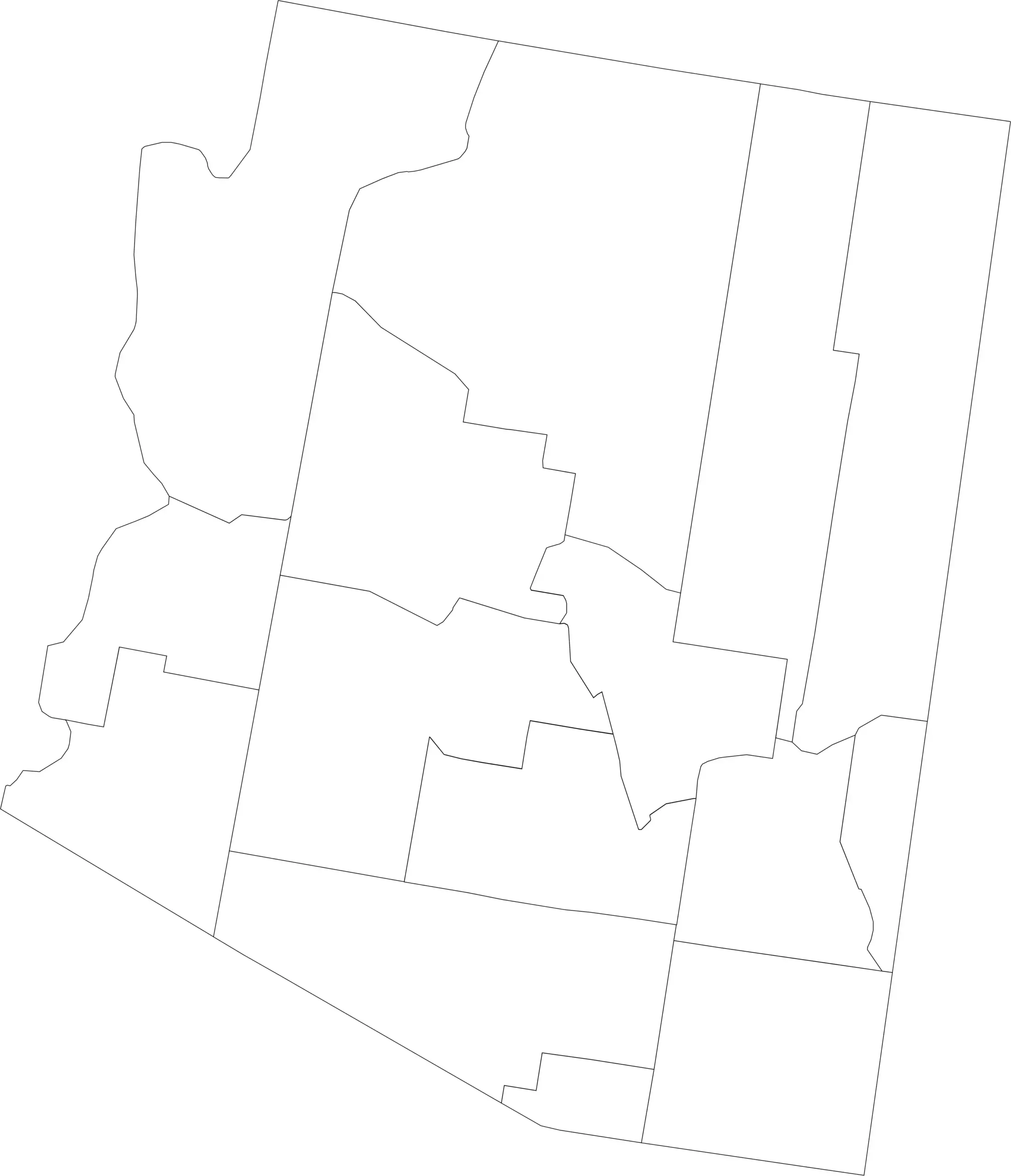
🌄 Blank Arizona County Map (No Labels)
For teachers, quiz creators, or anyone learning Arizona geography, here’s a blank version of the county map.
You can use it for labeling exercises, coloring, or custom mapping projects.
🖼️ Arizona County Map (without labels):
🧭 About Arizona’s Counties
- Maricopa County — The most populous county, home to Phoenix, the state capital.
- Coconino County — One of the largest counties in the U.S. by land area, containing the Grand Canyon.
- Pima County — Includes Tucson and many cultural and natural attractions.
- Yuma County — Known for its agriculture and warm climate year-round.
Each county has its own character — from mountain regions and forests to desert plains.
🧾 Uses for the Arizona County Map
You can use these county maps for:
✅ Educational worksheets
✅ Travel planning
✅ Data visualization
✅ Research projects
✅ Art and design projects
📥 Download Arizona County Maps
Choose from two free versions of the Arizona county map below:
Both versions are printable and free to use for educational and personal projects.
🗺️ Arizona Counties by Population
Below is a complete list of all 15 counties in Arizona along with their 2025 estimated populations. Maricopa County, home to Phoenix, is by far the largest, while Greenlee County has the smallest population. This table helps visualize how Arizona’s population is distributed across its diverse regions — from the deserts of Yuma to the mountain forests of Coconino.
| County | Population (2025 est.) |
|---|---|
| Maricopa County | 4,645,947 |
| Pima County | 1,074,534 |
| Pinal County | 522,643 |
| Yavapai County | 254,783 |
| Mohave County | 229,236 |
| Yuma County | 221,915 |
| Coconino County | 144,970 |
| Cochise County | 122,946 |
| Navajo County | 109,925 |
| Apache County | 64,042 |
| Gila County | 54,165 |
| Santa Cruz County | 50,114 |
| Graham County | 40,931 |
| La Paz County | 17,060 |
| Greenlee County | 9,453 |
Source: World Population Review — Arizona Counties by Population (2025).
🧠 Frequently Asked Questions About the Arizona County Map
How many counties are in Arizona?
Arizona has 15 counties, each serving as a local government unit within the state.
Which is the largest county by population?
Maricopa County is the most populous county in Arizona and includes Phoenix, the state capital, with over 4.6 million residents.
Which county is the largest by land area?
Coconino County is the largest county by land area in Arizona and one of the largest in the United States.
What is the smallest county in Arizona?
Santa Cruz County is the smallest by population, while Mohave County is smaller by land area compared to the largest counties.
Does Arizona use counties for local government?
Yes. Arizona counties provide essential services such as law enforcement, courts, elections, public health, and road maintenance.
What is the Arizona county map with labels used for?
A labeled county map helps users identify county boundaries, major cities, and regional divisions across the state.
What is the blank Arizona county map used for?
The blank map is ideal for educational labeling, classroom activities, quizzes, homeschooling, and custom mapping projects.
Are Arizona counties divided into regions?
Yes. Arizona is commonly divided into regions such as Northern Arizona, Central Arizona, Southern Arizona, and the Phoenix and Tucson metro areas.
Why are Arizona counties important for planning and services?
Counties manage local governance, transportation networks, public services, and land use planning, supporting both urban and rural areas across the state.
🌎 Explore More Maps
View more nearby state maps:


