🗺️ Connecticut County Map (With and Without Labels)
Connecticut, one of the original 13 colonies, is a small but historically rich state located in southern New England. Known for its charming towns, scenic coastlines, and vibrant history, Connecticut is divided into 8 counties — each with unique character and significance.
Below, you’ll find two versions of the Connecticut County Map: one with county labels and one blank without labels for learning and creative projects.
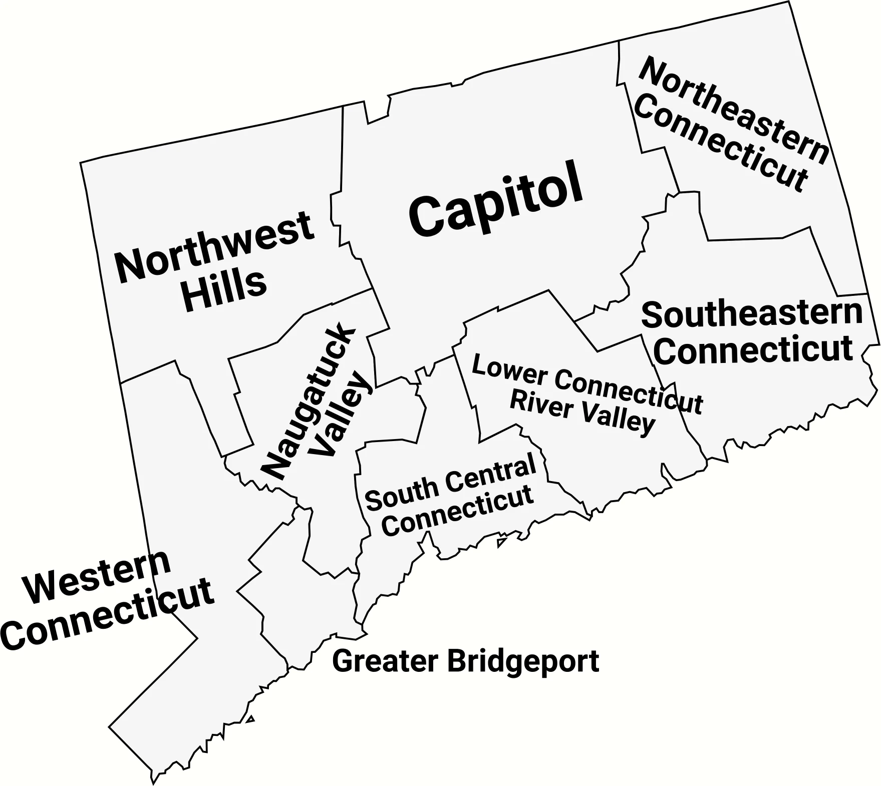
📍 Connecticut County Map with Labels
The labeled Connecticut county map below shows all 8 counties clearly marked. This version is great for studying state geography, school projects, or general reference.
🖼️ Connecticut County Map (with labels):
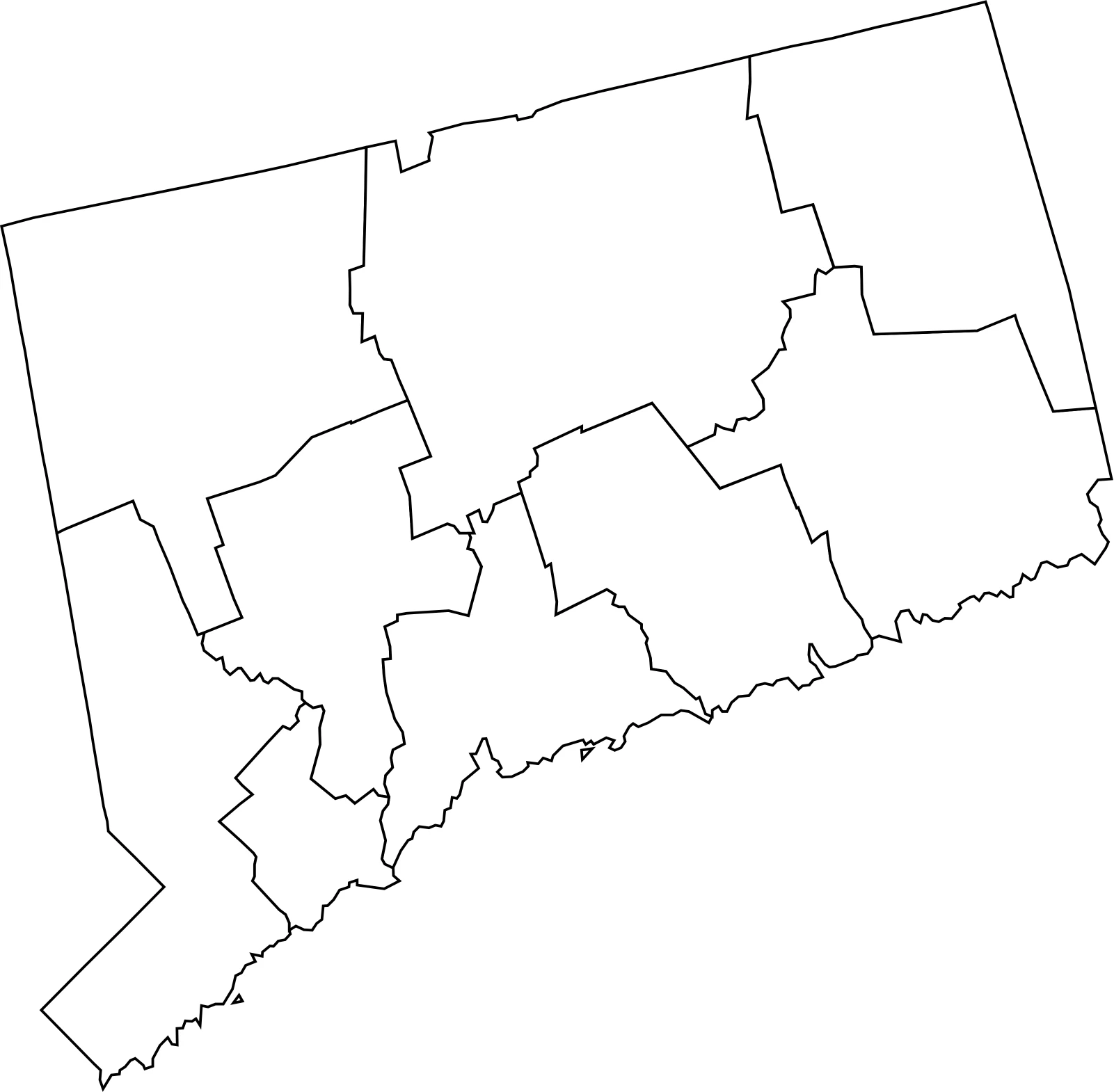
🌄 Blank Connecticut County Map (No Labels)
The blank county map of Connecticut is perfect for quizzes, educational use, or coloring activities. You can print it and label the counties yourself — a great way to learn about the geography of New England.
🖼️ Connecticut County Map (without labels):
🧭 About Connecticut’s Counties
Connecticut’s 8 counties — though they no longer have county governments — remain important for historical, geographical, and statistical purposes.
Here are a few of the most notable:
- Fairfield County — Home to cities like Stamford and Bridgeport, known for its coastal communities and proximity to New York City.
- Hartford County — Contains the state capital, Hartford, and many cultural landmarks.
- New Haven County — Home to Yale University and a rich industrial history.
- Litchfield County — A rural area famous for rolling hills and historic towns.
Each county reflects a different part of Connecticut’s identity — from coastal life to rural charm.
🧾 Uses for the Connecticut County Map
You can use these maps for:
✅ Educational activities and school projects
✅ Geography and history lessons
✅ Data visualization or research
✅ Travel or regional planning
✅ Coloring and design projects
📥 Download Connecticut County Maps
Choose from two free, printable versions of the map below:
Both versions are high-quality, easy to print, and perfect for educational or personal use.
Connecticut County-Equivalents (Planning Regions) — Population (2025)
Connecticut no longer functions the same way as most states with historic counties for federal statistics. The state’s planning regions / councils of governments were designated as county-equivalents for Census use. Below is a full table of the 9 Connecticut planning regions (the modern county-equivalents) with their 2025 estimated populations.
| County-Equivalent (Planning Region) | Population (2025 est.) |
|---|---|
| Capitol Planning Region | 981,848 |
| Western CT Planning Region | 626,007 |
| South Central CT Planning Region | 567,670 |
| Naugatuck Valley Planning Region | 461,204 |
| Greater Bridgeport Planning Region | 328,703 |
| Southeastern CT Planning Region | 280,388 |
| Lower CT River Valley Planning Region | 176,681 |
| Northwest Hills Planning Region | 113,835 |
| Northeastern CT Planning Region | 97,780 |
Source: 2025 population estimates from World Population Review (Connecticut planning regions / county-equivalents).
FAQs About Connecticut Counties and Population
How many counties are in Connecticut?
Connecticut has 9 planning regions that serve as modern county-equivalents. While the state originally had 8 traditional counties, county governments were abolished in 1960, and these new regions now handle most local and regional planning functions.
What are Connecticut’s planning regions?
The 9 planning regions are: Capitol, Western CT, South Central CT, Naugatuck Valley, Greater Bridgeport, Southeastern CT, Lower CT River Valley, Northwest Hills, and Northeastern CT. These correspond to the areas represented by Connecticut’s councils of governments (COGs).
Why did Connecticut replace its counties?
Connecticut abolished county governments in 1960 to streamline administration and reduce overlapping services. Today, regional planning and coordination are managed by the councils of governments, which became official county-equivalents recognized by the U.S. Census Bureau in 2022.
Which region has the largest population?
The Capitol Planning Region (which includes Hartford and its surrounding towns) is the most populous, with nearly 982,000 residents as of 2025.
Which region has the smallest population?
The Northeastern Connecticut Planning Region is the least populated, with just under 100,000 residents. It includes smaller towns and rural communities near the Rhode Island and Massachusetts borders.
What is the largest city in Connecticut?
Bridgeport is Connecticut’s largest city by population, followed by New Haven, Stamford, and Hartford. Each of these cities anchors one of the state’s planning regions.
Is there a map of Connecticut counties or regions?
Yes. A Connecticut county map with labels shows all 9 planning regions and their boundaries. You can also download a blank outline map for educational projects or custom data mapping.
How does Connecticut compare to other states in population?
Connecticut ranks near the middle among U.S. states in population, with around 3.6 million residents. Despite its small size, it has one of the nation’s highest population densities.
What replaced county government services in Connecticut?
Most former county responsibilities were transferred to the state government or to the individual towns and cities. The councils of governments now provide regional cooperation for planning, transportation, and infrastructure.


