🗺️ Delaware County Map (With and Without Labels)
Delaware, known as The First State, may be small in size, but it has a rich history and a strong identity. Located on the Atlantic Coast, Delaware is divided into just three counties — the fewest of any U.S. state. Each one has its own distinct character and role in Delaware’s history and geography.
Below, you can explore two versions of the Delaware County Map: one with county labels and another blank without labels for study or creative use.
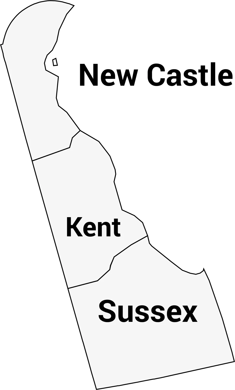
📍 Delaware County Map with Labels
The labeled Delaware county map below clearly marks all three counties — New Castle, Kent, and Sussex.
This map is great for educational reference, travel planning, or anyone wanting to understand the layout of Delaware’s regions.
🖼️ Delaware County Map (with labels):
Download Labeled Delaware County Map (webP)
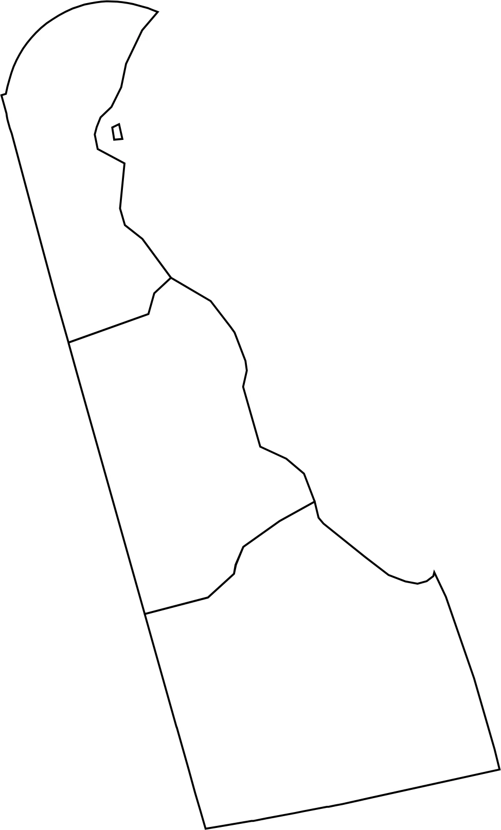
🌄 Blank Delaware County Map (No Labels)
For teachers, students, and map enthusiasts, here’s a blank Delaware county map that outlines the borders of the state’s three counties. It’s perfect for labeling activities, geography quizzes, or classroom projects.
🖼️ Delaware County Map (without labels):
Download Blank Delaware County Map (webP)
🧭 About Delaware’s Counties
Delaware’s three counties are each unique in geography and culture:
- New Castle County — Located in the north, this county includes Wilmington and most of Delaware’s urban population.
- Kent County — The central county, home to Dover, the state capital.
- Sussex County — Covers the southern part of the state and is known for beaches, agriculture, and small-town charm.
Despite its small size, Delaware offers a wide range of landscapes — from river valleys and historic cities to quiet coastal towns.
🧾 Uses for the Delaware County Map
These maps are useful for:
✅ School and geography lessons
✅ Travel and local research
✅ County boundary reference
✅ Coloring and educational projects
✅ Custom data visualization
📥 Download Delaware County Maps
You can download free printable versions of the Delaware maps below:
Both are perfect for printing, teaching, and learning.
📊 Delaware Counties by Population
Delaware is one of the smallest U.S. states by area and population, but it’s divided into three counties — the fewest of any state in the country. Each county has its own unique character, from the urban center around Wilmington to the beaches and rural landscapes in Sussex.
Here’s a look at the latest county population estimates (2024–2025):
| County | Estimated Population |
|---|---|
| New Castle County | 588,093 |
| Sussex County | 271,134 |
| Kent County | 192,690 |
🔍 Quick Facts
- New Castle County is the most populous, home to more than half the state’s residents and including the city of Wilmington.
- Sussex County is known for its coastal communities and rapid growth.
- Kent County includes the state capital, Dover, and is the least populous of the three.
🧠 Frequently Asked Questions About the Delaware County Map
How many counties are in Delaware?
Delaware has just 3 counties, making it one of the states with the fewest counties in the U.S.
What are the three counties in Delaware?
Delaware’s counties are New Castle County, Kent County, and Sussex County.
Which is the largest county by population?
New Castle County is the most populous county in Delaware and includes the city of Wilmington.
Which is the largest county by land area?
Sussex County is the largest county by land area and covers most of southern Delaware.
Does Delaware use counties for local government?
Yes. Counties in Delaware provide local services such as zoning, public safety, elections, and infrastructure management.
What is the smallest county in Delaware?
Kent County is the smallest by population, while New Castle County is the smallest by land area.
What is the Delaware county map with labels used for?
A labeled county map helps users identify county boundaries, major cities, and regional divisions across the state.
What is the blank Delaware county map used for?
The blank map is ideal for education, classroom activities, labeling exercises, quizzes, and custom mapping projects.
Why does Delaware have so few counties?
Delaware’s small geographic size and early colonial administrative structure resulted in only three counties being established — a structure that has remained unchanged since the 18th century.
🌎 Explore More Maps
View more nearby state maps:


