🗺️ Florida County Map (With Cities)
Florida, known as the Sunshine State, is famous for its beaches, theme parks, and diverse landscapes — from the Gulf Coast to the Atlantic Ocean. The state is divided into 67 counties, each offering a unique blend of culture, history, and natural beauty.
Below, you’ll find two versions of the Florida County Map: one with county names labeled and one blank version without labels, ideal for educational or creative use.
📍 Florida County Map with Labels
The labeled Florida county map below shows all 67 counties clearly marked. This version is perfect for learning about Florida’s geography, planning trips, or understanding regional boundaries.
🖼️ Florida County Map (with labels):
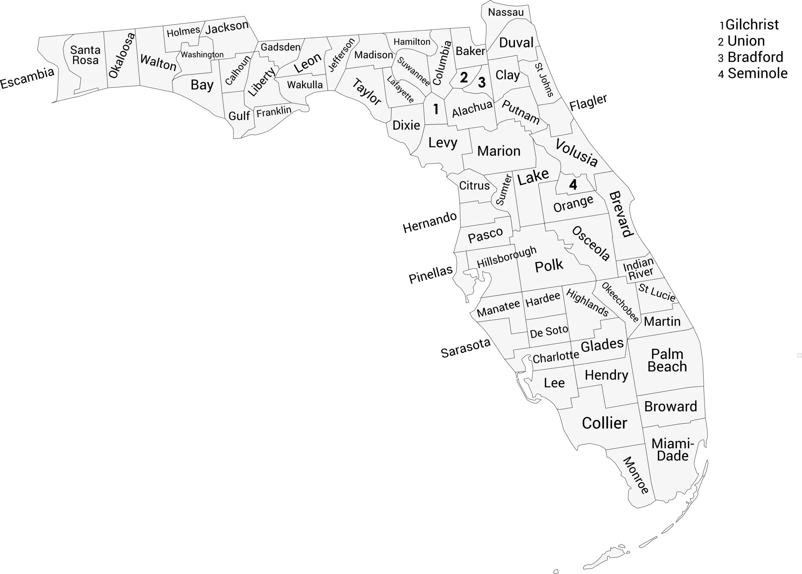
Download Labeled Florida County Map (webp)
🌴 Blank Florida County Map (No Labels)
The blank version of the Florida county map is perfect for classrooms, labeling exercises, or custom mapping projects. Use it for geography quizzes, coloring, or data visualization.
🖼️ Florida County Map (without labels):
(Insert blank county map image here)
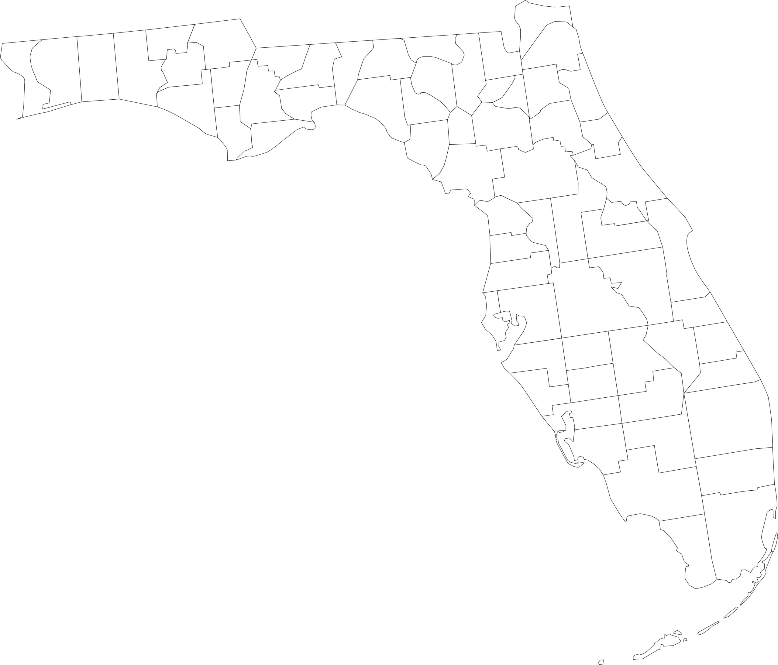
Download Blank Florida County Map (webp)
🧭 About Florida’s Counties
Florida’s counties range from bustling urban areas to quiet rural communities. Here are a few of the most notable:
- Miami-Dade County — The most populous county, home to Miami and vibrant cultural diversity.
- Orange County — Includes Orlando and the world-famous Walt Disney World Resort.
- Hillsborough County — Home to Tampa and a mix of coastal and city life.
- Duval County — Includes Jacksonville, the largest city by area in the continental U.S.
- Monroe County — Spans the beautiful Florida Keys and parts of the Everglades.
From beaches and wetlands to pine forests and city skylines, Florida’s counties show just how geographically and culturally varied the state is.
🧾 Uses for the Florida County Map
These maps are great for:
✅ Geography and classroom lessons
✅ Travel and trip planning
✅ County-level research or data visualization
✅ Coloring, labeling, and educational projects
✅ Business or demographic reference
📥 Download Florida County Maps
Choose from two free, printable versions of the map below:
Both versions are high-resolution, printable, and perfect for educational or personal use.
List of Florida Counties with Population
Here is a complete list of all 67 Florida counties with their April 1, 2024 population estimates (Vintage 2024) from Florida’s Office of Economic & Demographic Research / BEBR and the U.S. Census Bureau.
| County | Population Estimate (2024) |
|---|---|
| Alachua | 285,994 |
| Baker | 29,882 |
| Bay | 190,769 |
| Bradford | 27,858 |
| Brevard | 653,703 |
| Broward | 2,037,472 |
| Calhoun | 13,470 |
| Charlotte | 206,134 |
| Citrus | 166,696 |
| Clay | 237,339 |
| Collier | 416,233 |
| Columbia | 73,063 |
| DeSoto | 35,979 |
| Dixie | 17,465 |
| Duval | 1,058,444 |
| Escambia | 326,928 |
| Flagler | 128,283 |
| Franklin | 12,594 |
| Gadsden | 43,833 |
| Gilchrist | 19,587 |
| Glades | 14,272 |
| Gulf | 15,693 |
| Hamilton | 13,471 |
| Hardee | 25,760 |
| Hendry | 42,898 |
| Hernando | 206,365 |
| Highlands | 107,614 |
| Hillsborough | 1,581,426 |
| Holmes | 19,944 |
| Indian River | 169,795 |
| Jackson | 48,622 |
| Jefferson | 15,450 |
| Lafayette | 8,078 |
| Lake | 453,206 |
| Lee | 858,937 |
| Leon | 296,913 |
| Levy | 46,545 |
| Liberty | 7,706 |
| Madison | 18,519 |
| Manatee | 441,095 |
| Marion | 409,959 |
| Martin | 163,315 |
| Miami-Dade | 2,838,461 |
| Monroe | 80,614 |
| Nassau | 99,151 |
| Okaloosa | 218,464 |
| Okeechobee | 43,443 |
| Orange | 1,558,673 |
| Osceola | 468,266 |
| Palm Beach | 1,544,853 |
| Pasco | 592,955 |
| Pinellas | 1,011,799 |
| Polk | 878,226 |
| Putnam | 75,881 |
| St. Johns | 341,305 |
| St. Lucie | 402,986 |
| Santa Rosa | 203,162 |
| Sarasota | 481,935 |
| Seminole | 494,605 |
| Sumter | 154,693 |
| Suwannee | 46,130 |
| Taylor | 21,582 |
| Union | 15,532 |
| Volusia | 611,741 |
| Wakulla | 36,449 |
| Walton | 86,354 |
| Washington | 25,602 |
🧠 Frequently Asked Questions About the Florida County Map
How many counties are in Florida?
Florida has 67 counties, each serving as an important unit of local government across the state.
Which is the largest county by population?
Miami-Dade County is the most populous county in Florida, home to the city of Miami and more than 2.7 million residents.
Which county is the largest by land area?
Palm Beach County is the largest county by land area in Florida, stretching from the Atlantic coast to Lake Okeechobee.
What is the smallest county in Florida?
Union County is the smallest county by land area, while Liberty County is the least populated.
Does Florida use counties for local government?
Yes. Florida counties provide essential services such as law enforcement, courts, elections, public health, zoning, and infrastructure maintenance.
What is the Florida county map with labels used for?
A labeled county map helps users identify county boundaries, major cities, and regional divisions throughout the state.
What is the blank Florida county map used for?
The blank map is ideal for educational labeling, quizzes, classroom activities, homeschooling, and custom mapping projects.
Are Florida counties divided into regions?
Yes. Florida is often divided into regions such as North Florida, Central Florida, South Florida, the Panhandle, and the Space Coast to describe geographic and cultural differences.
Why are Florida’s counties important for growth and planning?
Counties play a key role in managing Florida’s rapid population growth, tourism infrastructure, emergency management, and environmental protection.
🌎 Explore More Maps
View more nearby state maps:


