🗺️ Hawaii County Map (With and Without Labels)
Hawaii, known as the Aloha State, is unlike any other place in the United States. Made up entirely of islands in the Pacific Ocean, Hawaii features lush rainforests, volcanoes, and world-famous beaches.
The state is divided into just five counties, each representing one or more islands.
Below, you can view and download two versions of the Hawaii County Map — one with county labels and another blank version without labels. Both are provided in .webp format for fast loading and high-quality display.
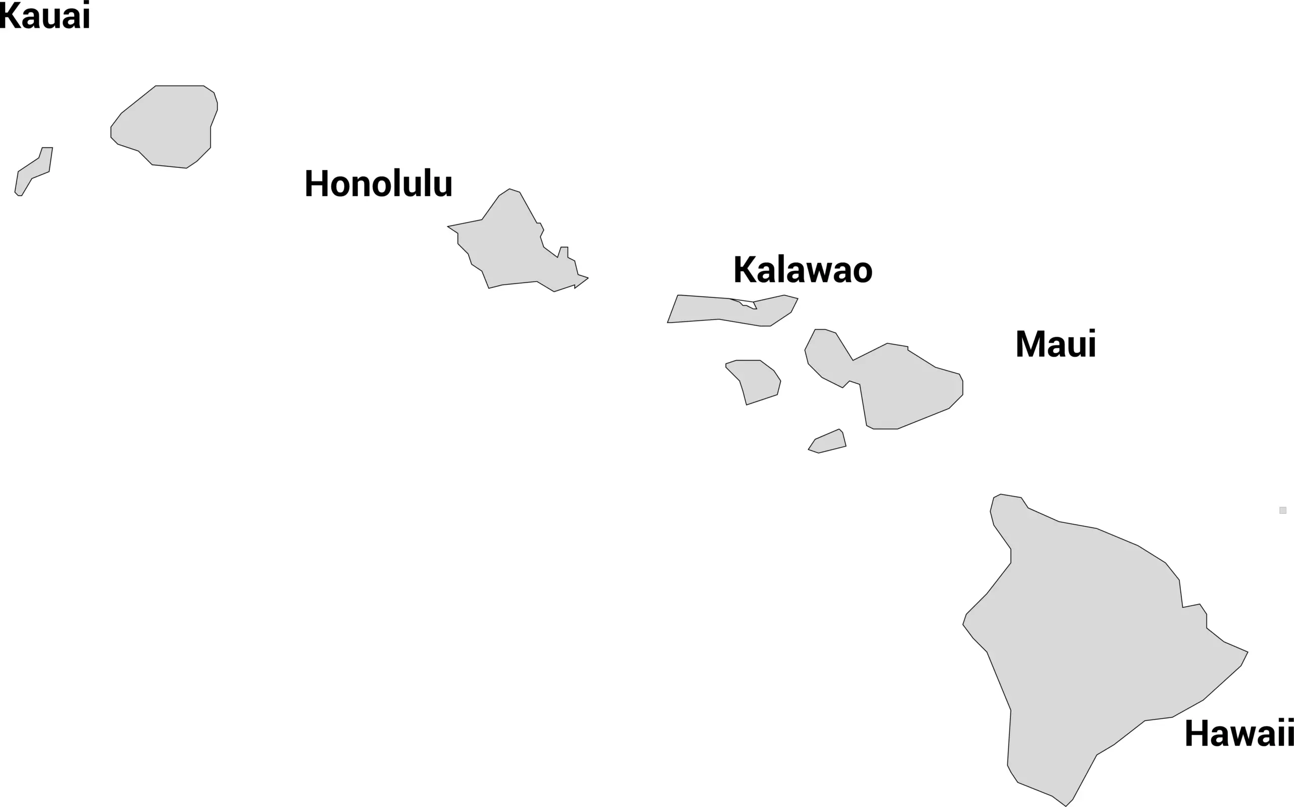
📍 Hawaii County Map with Labels
The labeled Hawaii county map below shows all five counties across the islands. It’s ideal for educational use, travel planning, or general reference.
🖼️ Hawaii County Map (with labels):
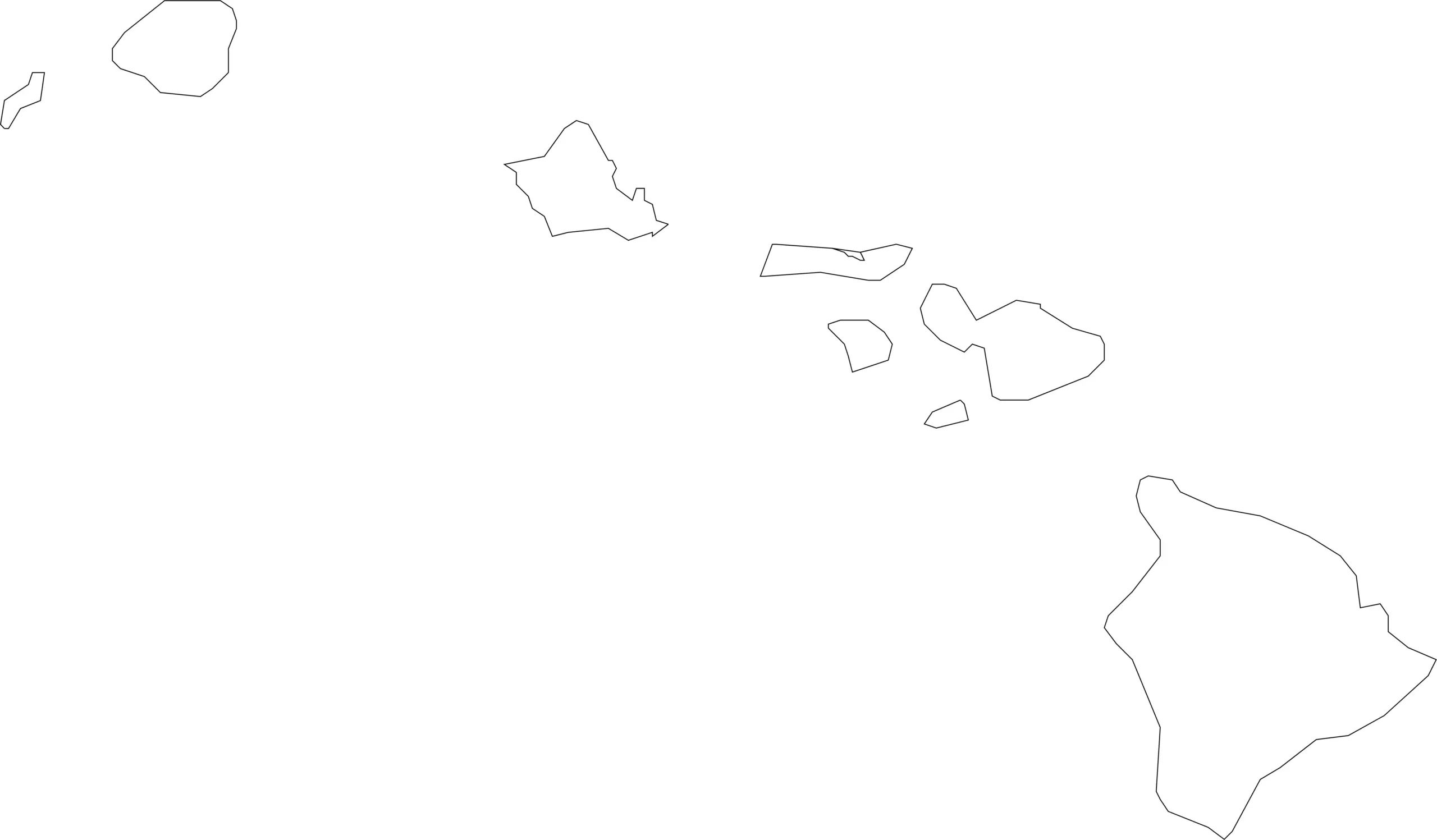
🌴 Blank Hawaii County Map (No Labels)
For teachers, students, or anyone studying Hawaiian geography, this blank county map is perfect for labeling activities, quizzes, or coloring projects.
🖼️ Hawaii County Map (without labels):
🧭 About Hawaii’s Counties
Hawaii’s counties are unique because they correspond to entire islands or groups of islands — and each has its own culture and natural beauty:
- Hawaii County — Known as the “Big Island,” it’s the largest and home to active volcanoes like Kīlauea and Mauna Loa.
- Maui County — Includes the islands of Maui, Moloka‘i (except the Kalawao district), Lāna‘i, and Kaho‘olawe.
- Honolulu County — Covers O‘ahu, where the state capital Honolulu and famous Waikiki Beach are located.
- Kauai County — Includes Kaua‘i and Ni‘ihau, known for their lush rainforests and scenic cliffs.
- Kalawao County — The smallest county, located on the island of Moloka‘i, with historical significance as a former leprosy settlement.
Each county offers a glimpse into Hawaii’s rich cultural diversity and stunning natural environment.
🧾 Uses for the Hawaii County Map
These maps can be used for:
✅ Classroom lessons and educational projects
✅ Geography quizzes and labeling exercises
✅ Travel research and island planning
✅ Coloring and art projects
✅ Data and demographic mapping
📥 Download Hawaii County Maps
Get free, high-resolution .webp versions of both maps below:
Both maps are free for educational and personal use and optimized for web display.
🗺️ Hawaii Counties by Population
Below is a complete list of all 5 counties in Hawaii with their 2025 estimated populations. The majority of the state’s population lives in the City & County of Honolulu.
| County | Population (2025 est.) |
|---|---|
| Honolulu County | 978,568 |
| Hawaii County | 210,149 |
| Maui County | 163,831 |
| Kauai County | 73,987 |
| Kalawao County | 81 |
Source: World Population Review — Hawaii Counties by Population (2025)
❓ Frequently Asked Questions About Hawaii Counties
How many counties are there in Hawaii?
Hawaii has 5 counties: Honolulu, Hawaii, Maui, Kauai, and Kalawao. Each one covers both land and surrounding ocean areas.
What is the largest county in Hawaii by population?
The City and County of Honolulu is the most populated, home to nearly 1 million residents. It includes the island of Oʻahu and the state capital, Honolulu.
Which county in Hawaii has the smallest population?
Kalawao County is the smallest both in size and population, with fewer than 100 residents. It is located on the island of Molokaʻi and historically known for the Kalaupapa leprosy settlement.
What is the largest county by land area?
Hawaii County (often called the Big Island) is the largest by area, covering more than 4,000 square miles — larger than all the other Hawaiian islands combined.
Does Hawaii have county governments like other U.S. states?
Yes, but Hawaii’s local government is unique. Counties in Hawaii handle many responsibilities that cities and towns manage elsewhere, such as police, fire, water, and public works. There are no incorporated cities other than Honolulu.
Which county is home to Maui and surrounding islands?
Maui County includes the islands of Maui, Lanai, Molokini, and most of Molokaʻi. Its largest city is Kahului.
What is the main island of each county?
- Honolulu County: Oʻahu
- Hawaii County: Island of Hawaii (Big Island)
- Maui County: Maui, Lanai, Molokini, part of Molokaʻi
- Kauai County: Kauai and Niʻihau
- Kalawao County: Northern Molokaʻi
Which county has the state capital?
Honolulu County is home to Honolulu, the capital of Hawaii, and the economic and political center of the state.
Where can I find Hawaii county maps?
This post includes both a labeled Hawaii county map with names and borders, and a blank county outline map that can be used for educational or project purposes.


