🗺️ Indiana County Map (With and Without Labels)
Indiana, known as the Hoosier State, features a mix of industrial cities, farmland, and scenic natural areas. The state is divided into 92 counties, each with its own unique history and landscape.
Below, you’ll find two versions of the Indiana County Map — one with county labels and another blank version without labels. Both are provided in .webp format for fast-loading, high-quality web images.
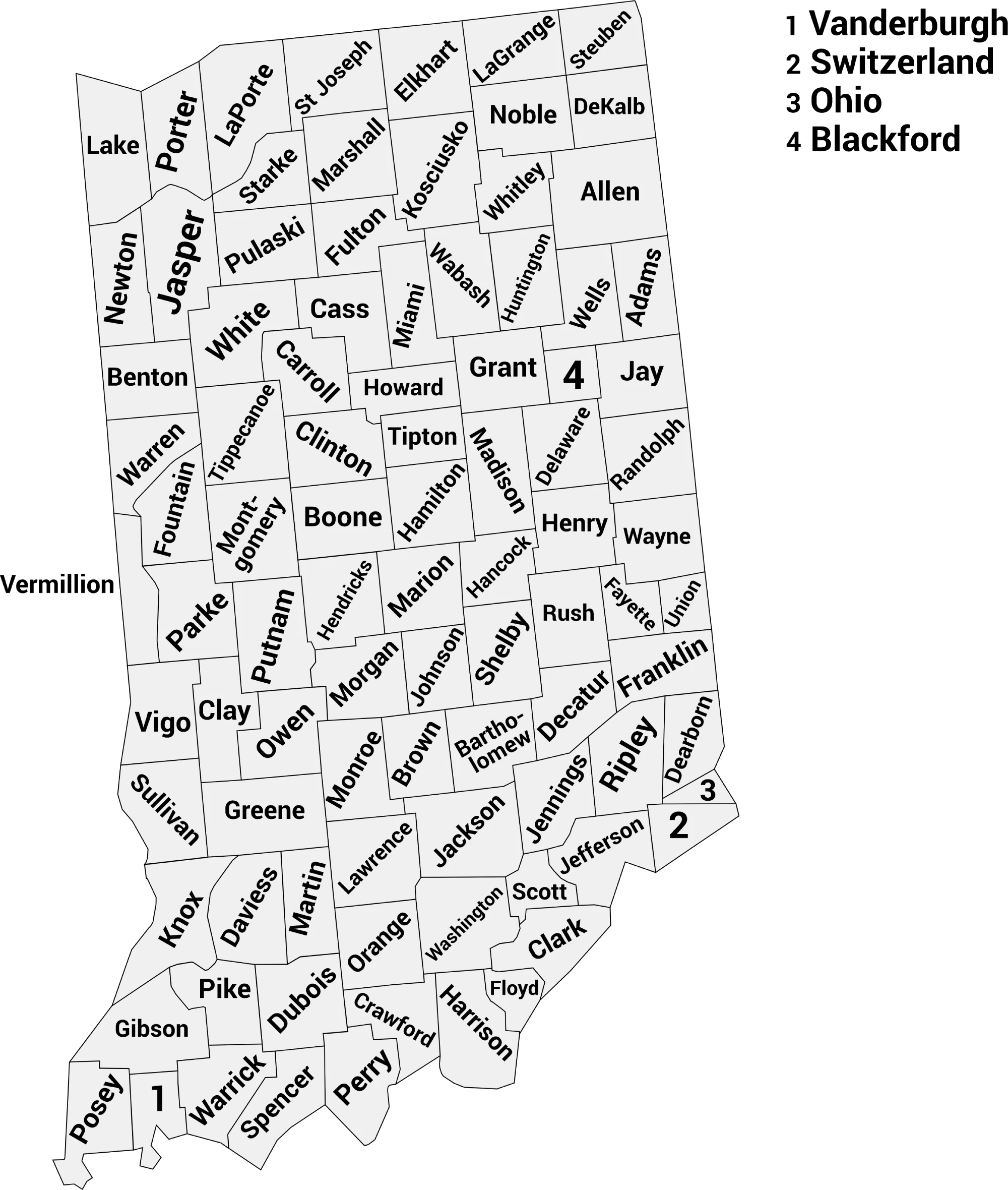
📍 Indiana County Map with Labels
The labeled Indiana county map below clearly shows all 92 counties, making it ideal for students, educators, or anyone looking to understand the geography of Indiana.
🖼️ Indiana County Map (with labels):
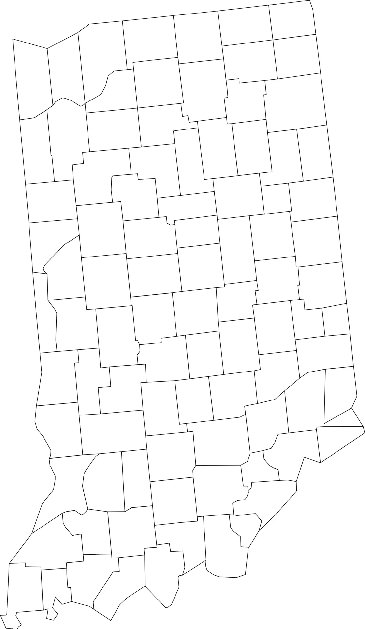
🌄 Blank Indiana County Map (No Labels)
The blank Indiana county map provides a clean outline of all counties without labels. It’s perfect for educational exercises, quizzes, or custom labeling projects.
🖼️ Indiana County Map (without labels):
👉 Download Blank Indiana County Map (.webp)
🧭 About Indiana’s Counties
Indiana’s counties feature a mix of urban, suburban, and rural areas. Here are a few notable ones:
- Marion County — Home to Indianapolis, the state capital and largest city.
- Lake County — Part of the Chicago metropolitan area in northwest Indiana.
- Allen County — Includes Fort Wayne, a major regional city.
- Tippecanoe County — Home to Lafayette and Purdue University.
- St. Joseph County — Contains South Bend, famous for the University of Notre Dame.
From the northern lakeshore to the southern hills, Indiana’s counties represent a diverse blend of industry, agriculture, and culture.
🧾 Uses for the Indiana County Map
These maps are great for:
✅ Classroom and educational use
✅ Geography quizzes and learning exercises
✅ Travel or regional planning
✅ Data visualization and county-level research
✅ Coloring and labeling projects
📥 Download Indiana County Maps
You can download high-quality .webp versions of both maps:
Both maps are printable, fast-loading for web, and perfect for personal, educational, or professional use.
📊 Indiana Counties by Population (2025 Estimates)
| County | Estimated Population (2025) |
|---|---|
| Marion County | 987,602 |
| Lake County | 505,319 |
| Allen County | 403,459 |
| Hamilton County | 386,820 |
| St. Joseph County | 273,830 |
| Elkhart County | 207,436 |
| Tippecanoe County | 192,818 |
| Hendricks County | 194,117 |
| Vanderburgh County | 180,387 |
| Porter County | 175,860 |
| Johnson County | 170,614 |
| Monroe County | 140,702 |
| Madison County | 134,222 |
| Clark County | 127,479 |
| Delaware County | 112,951 |
| LaPorte County | 111,348 |
| Vigo County | 106,166 |
| Hancock County | 88,810 |
| Bartholomew County | 84,741 |
| Howard County | 84,082 |
| Floyd County | 81,931 |
| Kosciusko County | 80,669 |
| Boone County | 78,773 |
| Morgan County | 73,825 |
| Grant County | 66,458 |
| Wayne County | 66,410 |
| Warrick County | 66,339 |
| Dearborn County | 51,435 |
| Henry County | 49,081 |
| Noble County | 47,811 |
| Jackson County | 47,420 |
| Marshall County | 46,464 |
| Shelby County | 45,654 |
| Lawrence County | 45,192 |
| DeKalb County | 44,330 |
| Dubois County | 43,629 |
| LaGrange County | 41,122 |
| Harrison County | 39,978 |
| Montgomery County | 38,633 |
| Putnam County | 37,804 |
| Cass County | 37,559 |
| Adams County | 36,699 |
| Huntington County | 37,070 |
| Miami County | 35,749 |
| Knox County | 35,717 |
| Steuben County | 34,848 |
| Daviess County | 34,393 |
| Jasper County | 33,318 |
| Gibson County | 33,157 |
| Clinton County | 32,911 |
| Jefferson County | 32,904 |
| Greene County | 31,306 |
| Ripley County | 29,220 |
| Wells County | 28,960 |
| Washington County | 28,501 |
| Jennings County | 27,654 |
| Decatur County | 26,447 |
| Clay County | 26,429 |
| Posey County | 25,087 |
| White County | 24,891 |
| Scott County | 24,877 |
| Randolph County | 24,314 |
| Starke County | 23,592 |
| Fayette County | 23,414 |
| Franklin County | 23,098 |
| Owen County | 21,927 |
| Carroll County | 20,924 |
| Sullivan County | 20,714 |
| Fulton County | 19,689 |
| Orange County | 19,937 |
| Perry County | 19,349 |
| Jay County | 20,259 |
| Brown County | 15,609 |
| Vermillion County | 15,669 |
| Tipton County | 15,353 |
| Fountain County | 16,992 |
| Rush County | 16,703 |
| Parke County | 16,533 |
| Newton County | 14,229 |
| Pulaski County | 12,408 |
| Pike County | 12,143 |
| Blackford County | 11,757 |
| Crawford County | 10,604 |
| Switzerland County | 10,011 |
| Martin County | 9,866 |
| Benton County | 8,945 |
| Warren County | 8,404 |
| Union County | 6,796 |
| Ohio County | 5,999 |
🔎 Notes & Highlights
- Marion County (Indianapolis) is by far the most populous county, with nearly 988,000 residents. World Population Review
- Ohio County is the least populous, with under 6,000 residents.
- The list reflects 92 total counties in Indiana.
🧠 Frequently Asked Questions About the Indiana County Map
How many counties are in Indiana?
Indiana has 92 counties, each serving as a unit of local government across the state.
Which is the largest county by population?
Marion County is the most populous county in Indiana and includes the state capital, Indianapolis, with over 970,000 residents.
Which county is the largest by land area?
Allen County in northeastern Indiana is the largest by land area.
What is the smallest county in Indiana?
Ohio County is the smallest county by both population and land area.
Does Indiana use counties for local government?
Yes. Counties in Indiana provide essential services such as law enforcement, courts, elections, health services, and road maintenance.
What is the Indiana county map with labels used for?
A labeled county map helps users identify county boundaries, major cities, and regional divisions across the state.
What is the blank Indiana county map used for?
The blank map is perfect for education, classroom labeling, quizzes, homeschooling, or custom mapping projects.
Are Indiana counties divided into regions?
Yes. Indiana is commonly divided into Northern Indiana, Central Indiana, Southern Indiana, and the Indianapolis Metro Area for geographic and cultural reference.
Why are Indiana counties important for planning and services?
Counties manage local governance, infrastructure, public safety, and development planning, supporting both rural and urban communities.
🌎 Explore More Maps
View more nearby state maps:


