🗺️ Maine County Map (With and Without Labels)
Maine, known as the Pine Tree State, is famous for its rocky coastline, dense forests, and maritime history. Located in the northeastern corner of the United States, Maine is divided into 16 counties, each with its own distinct geography and character.
Below, you’ll find two versions of the Maine County Map — one with county labels and one blank version without labels. Both maps are provided in .webp format for fast-loading, high-quality display on your website.
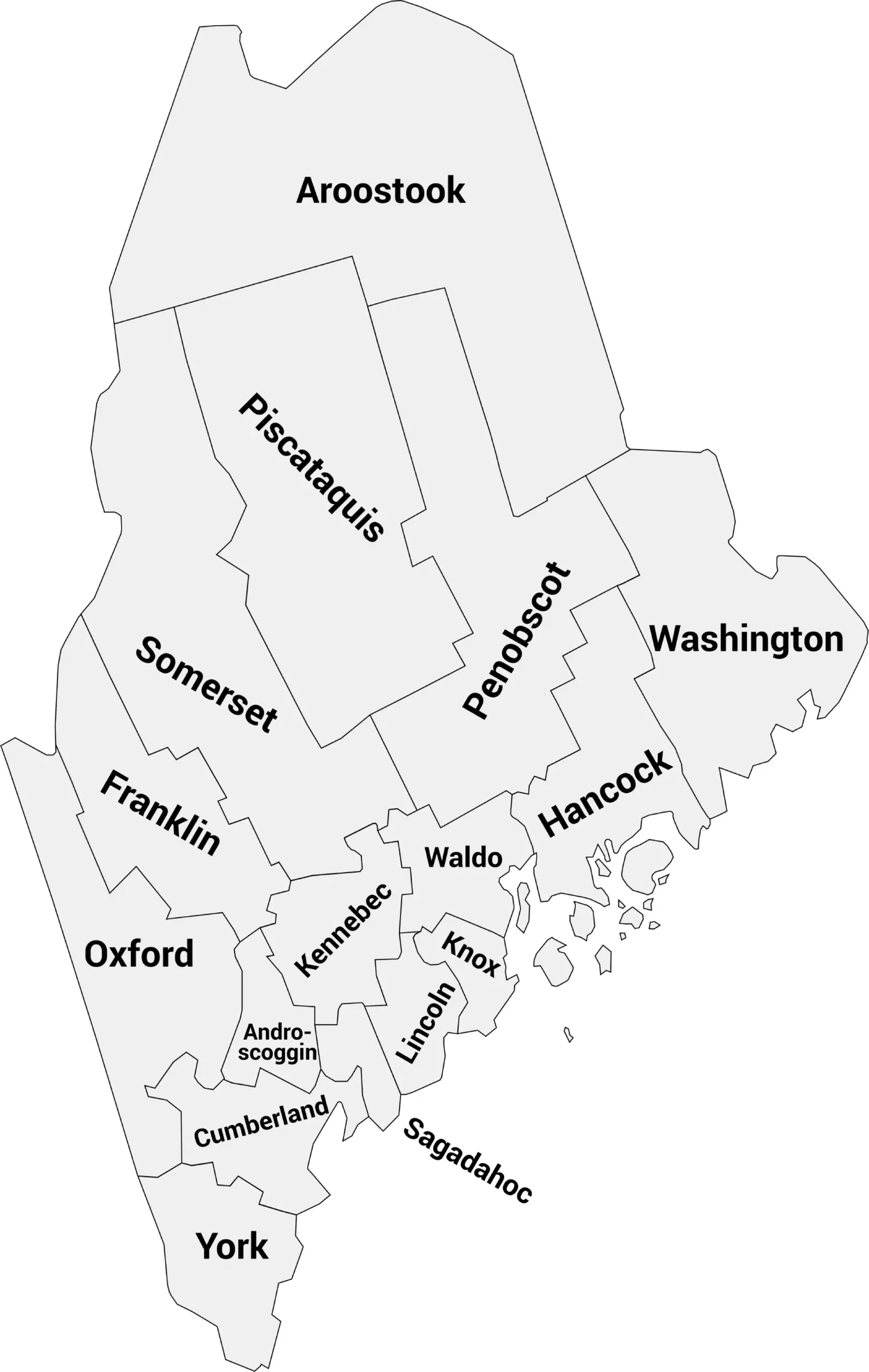
📍 Maine County Map with Labels
The labeled Maine county map below clearly shows all 16 counties. This map is ideal for students, teachers, travelers, or anyone studying Maine’s geography.
🖼️ Maine County Map (with labels):
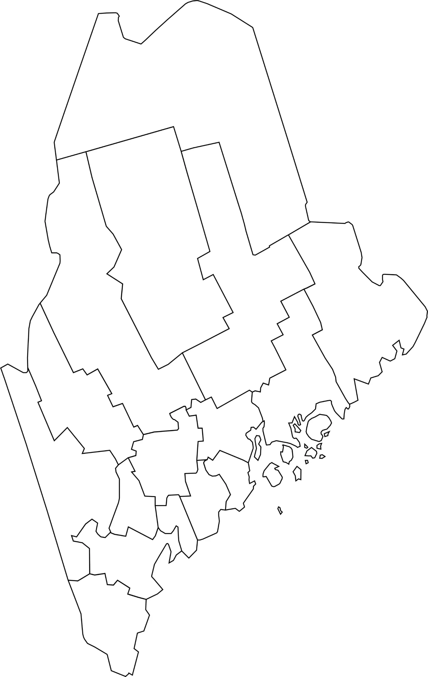
🌄 Blank Maine County Map (No Labels)
The blank Maine county map provides a clean outline of all counties without labels. It’s perfect for classroom exercises, geography quizzes, or custom labeling and coloring projects.
🖼️ Maine County Map (without labels):
🧭 About Maine’s Counties
Maine’s counties feature a mix of coastal regions, forests, and small towns. Here are a few notable counties:
- Cumberland County — Includes Portland, Maine’s largest city and cultural hub.
- York County — Southernmost county, known for beaches and historic towns.
- Penobscot County — Contains Bangor, a central city for commerce and education.
- Hancock County — Includes Bar Harbor and Mount Desert Island, home to Acadia National Park.
- Androscoggin County — Includes Lewiston and Auburn, important economic centers.
Each county showcases a unique part of Maine’s natural beauty and cultural heritage.
🧾 Uses for the Maine County Map
These maps are useful for:
✅ Classroom lessons and educational projects
✅ Geography quizzes and labeling exercises
✅ Travel planning and local research
✅ Data visualization and county-level analysis
✅ Coloring and creative projects
📥 Download Maine County Maps
You can download high-quality .webp versions of both maps:
Both maps are printable, fast-loading for web, and perfect for educational, personal, or professional use.
📊 Maine Counties by Population (Estimated)
| County | Estimated Population |
|---|---|
| Androscoggin County | 111,000 |
| Aroostook County | 67,000 |
| Cumberland County | 311,000 |
| Franklin County | 30,000 |
| Hancock County | 56,000 |
| Kennebec County | 124,000 |
| Knox County | 40,000 |
| Lincoln County | 36,000 |
| Oxford County | 58,000 |
| Penobscot County | 153,000 |
| Piscataquis County | 16,000 |
| Sagadahoc County | 36,000 |
| Somerset County | 50,000 |
| Waldo County | 40,000 |
| Washington County | 31,000 |
| York County | 219,000 |
🧠 Frequently Asked Questions About the Maine County Map
How many counties are in Maine?
Maine has 16 counties, each serving as a local government unit within the state.
Which is the largest county by population?
Cumberland County is the most populous county in Maine and includes Portland, the state’s largest city.
Which county is the largest by land area?
Aroostook County is the largest county by land area in Maine and one of the largest counties in the eastern United States.
What is the smallest county in Maine?
Sagadahoc County is the smallest county by population, while Lincoln County is one of the smallest by land area.
Does Maine use counties for local government?
Yes. Maine counties provide services such as law enforcement, courts, elections, and public records, though many municipal services are handled at the town or city level.
What is the Maine county map with labels used for?
A labeled county map helps users identify county boundaries, major cities, and regional divisions across Maine.
What is the blank Maine county map used for?
The blank map is ideal for educational labeling, classroom exercises, quizzes, homeschooling, and custom mapping projects.
Are Maine counties divided into regions?
Yes. Maine is often divided into regions such as Southern Maine, Midcoast, Western Maine, Northern Maine, and the Downeast Coast.
Why are Maine counties important for planning and services?
Counties help manage local governance, infrastructure, emergency services, and public records across a state with a mix of urban areas and vast rural regions.
🌎 Explore More Maps
View more nearby state maps:


